Scan2BIM: Stadelhofen train station, Zürich
Refurbishment made simple
Switzerland’s transport infrastructure is bursting at the seams. As the shortage of development space becomes ever more acute, new projects to relieve or complement our existing mobility infrastructure are subject to increasingly complex constraints. Faithful visualizations of the existing urban fabric increase the precision of refurbishment and remodeling schemes, as illustrated by the Zurich-Stadelhofen station project.
Opened in 1991, the three-track Stadelhofen station in Zurich is slowly reaching the limits of its capacity. A fourth station track and a second Riesbach tunnel were planned in order to relieve congestion. As part of an engineering consortium, Gruner has been entrusted with various project tasks.
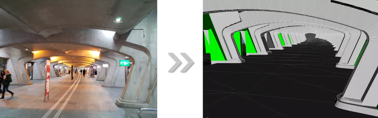
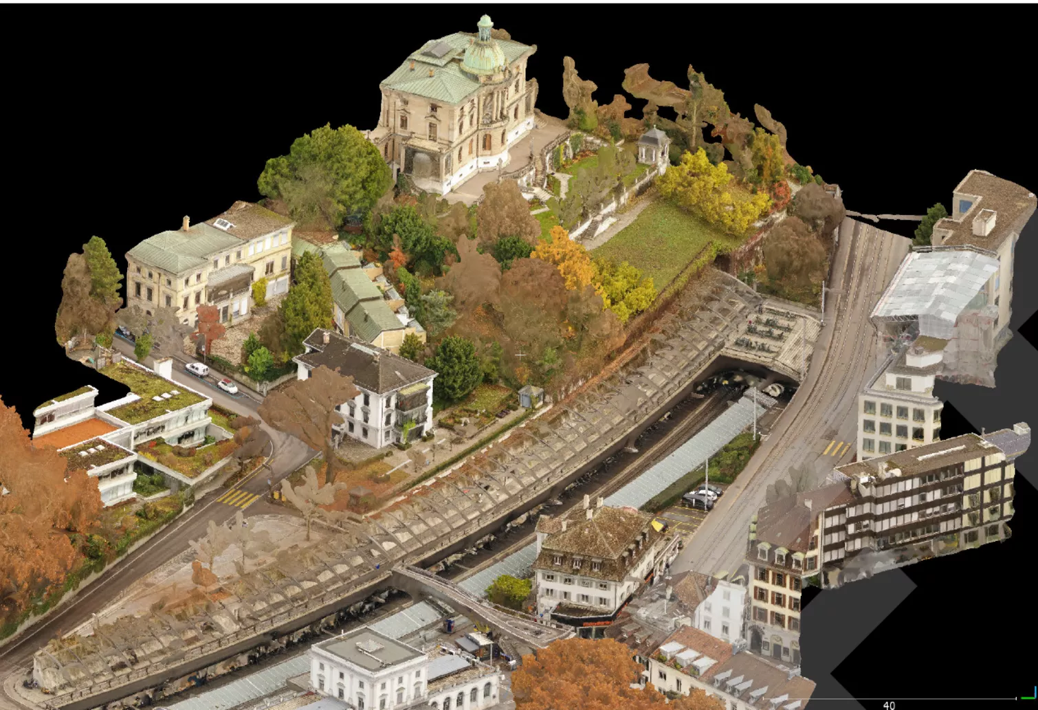
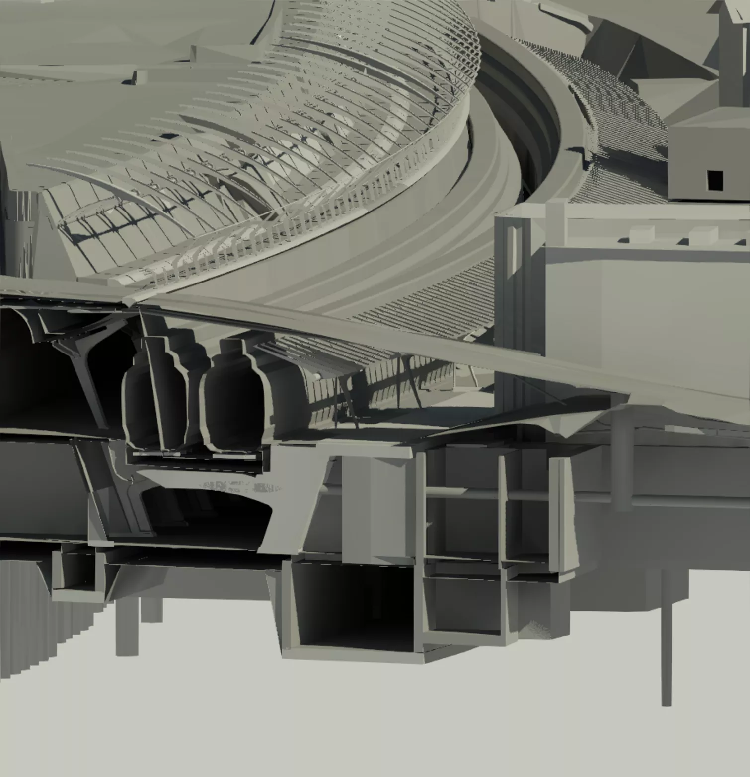
As there was practically no reliable 3D data on the present buildings and facilities, Gruner was mandated to produce a survey of the existing development, in all its complexity and inhomogeneity, using a combination of terrestrial laser scanning (TLS) and tachymetric surveying. Performed under operating conditions, these surveys were used in conjunction with laser scanning data from 2017 for the station track to generate 3D surface bodies, which, in turn, served as the basis for a complete model of the existing fabric. The model replicates the open, contorted topography, all levels of the operating facilities, the retail units, mechanical rooms and storerooms, installation ducts, stairways and a wide range of specific features, as well as the bored pile walls with walings and the bridges over the track. This geo-referenced model is produced to an accuracy that provides a reliable basis not only for the concept design, but also for the detailed design, the plans for public display, the tendering procedure and, if required, for the technical design.
Initially, Gruner performed a 3D laser scan of the indoor and outdoor spaces for later analysis in the office. Here, the point clouds obtained from various survey positions are combined into a coherent whole. This delivers a rotatable, virtual-walk-through 3D model in the panorama viewer. The viewer also allows determination of the heights, distances and angles from specific point clouds. The next step involves turning the point clouds into integral surfaces for presentation in a 3D model. This model offers a professional and economical means of generating any required plan views and cross-sections. These can then be exported in DXF or another format for further processing, thereby laying a sound foundation for a successful project.
Services
- Geomatics
- Scan2BIM